

Nemo Outdoor Graphical User Interface
Introduction:- |
Nemo Outdoor Graphical User Interface |
 |
Nemo Outdoor Graphical User Interface |
Line Graphs allow the user to accurately observe the measurement information.
• zoom
• thresholds
• scale
• selectable parameters & values
• selectable layers & values
• average value presentation
• displaying events & notifications
 |
Windows: Graphs |
NEMO Outdoor Workspace and Hardware Configuration:-
By saving the workspace, different views
can be saved to a .wor file. The following views are saved to the file:
1.Device Information Window views
2.Grid and Graph views
3.Color Set and Parameter selected in the Map Window (Map layers must be saved to MapInfo .gst file)
4.By saving the hardware configuration file, the information related to device(s) is saved to the .hwc file:
5.All information defined in the Measurement Properties Window
 |
Bar Graph |
 |
Line Graph |
 |
Scatter PLOT |
 |
Scanning Results |
Windows: Grids
The user can easily select the events, parameters, and statistics to be displayed in the grid table. It is also possible to highlight certain events with color to improve the clarity of the results presented. Double-click on an event to view more information about that particular event. |
Parameters |
 |
EVENTS |
 |
UP>Layers3,Down>Decoded Layer 3, D'Left>Statistics |
 |
| LEFT>Textual Window...Right>Graphical Window |
1. Statistics
2. Decoded Layer3
3. Parameters
4. Events
5. Table
6. Layer3
Right:-
• Scatter plot
• Line graph
• Bar graph
• Scanning Plots
Nemo Indoor & Floor plan
• Nemo Indoor supports indoor floor plan in .tab; .bmp; .jpg; .tif formats.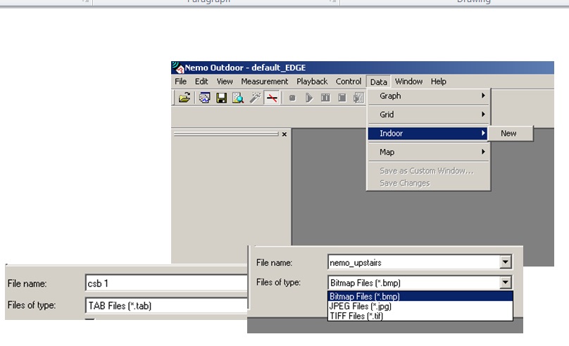 |
NEMO Indoor Outdoor PLAN |
Nemo Indoor & Floor plan
• During measurement, markers( ) need to be inserted in order to plot route on floor plan. |
Nemo Indoor & Floor plan |
Nemo Indoor & Floor plan
• Indoor floor plan properties |
Nemo Indoor & Floor plan |
Nemo Outdoor and MS BTS File
 |
Nemo Outdoor and MS BTS File |
Multiple Real-time Route Coloring
 |
A line from the test vehicle to the serving and neighboring BTS can be drawn. |
 |
New multi route feature allows users to compare easily measurements from different terminals on the same map or to correlate different parameters from the same terminal. |
Files Used by Nemo Outdoor
BTS files
• .bts, .nbf• MAP files
• MapInfo vector and raster maps
• Result files
• .dt1, .dt2, .dt3, .dt4
• .fs1, fs1, fsn…
• .ft1, ft2, ftn…
Workspace files
• .wor• Hardware configuration files
• .hwc
• Script files
• .nsf
Nemo Outdoor Measurement File
• With Call mode measurements, *.DT1 file is produced.• With Frequency/Pilot Scan (Separate Scanner) measurements , *.FS file is produced.
• Open ASCII non-proprietary file format
• Easy to view and use
Nemo Outdoor Measurement File Contents
• Field strength results of the serving and neighbouring cells• Quality class values
• Mobile output power level
• Layer 3, layer 2, RLC/MAC, LLC and RRC messages
• Geographical coordinates and time
• Call events and handover events
• Location update events
• Channel information
• Other information
Example of Nemo Outdoor Measurement File header
 |
Example of Nemo Outdoor Measurement File header |
No comments:
Post a Comment